Journey to the Most Remote: Overlanding
Share
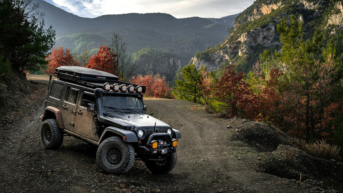
Overlanding is the act of traveling to desolate locations and regions for days, weeks, or even months, relying heavily on a combination of tools, technology, and, most importantly, self-sufficiency. While this brief description captures the essence of it, overlanding encompasses much more. It involves extensive planning and preparation, a sense of adaptability, and problem-solving skills, as you will primarily navigate uncharted territory.
Vacations are not solely about going from A to B; the goal is your destination and what you’ll do there. Road tripping is more about the journey, but still, it’s just driving from your hometown to a destination, usually a few hours or a couple of days away. On the other hand, off-roading is all about conquering the unpaved terrain, but you do it, then go back home. Car camping may be slightly related to overlanding, but you’re traveling to an establishment, a campsite, and staying in your vehicle. While these activities are fun in their own ways, and there are things you can learn from these and incorporate into your overlanding adventures, they have little to no connection to the essence of overlanding.
What is Overlanding?
Overlanding is remote traveling, and “travel” itself is the goal of what you’re doing. It is not necessarily about conquering the roughest trails or going somewhere and spending time in your modified truck. It’s more about nature, discovery, tackling difficulties, and respecting the environment. Your skills in planning, mechanical stuff, and even survival play a crucial role in these adventures. When you’re overlanding, it is about the journey and the experiences, the in-between portion of the A-to-B.

Overlanding Trails in the USA
The USA is one of the most diverse countries in the world when it comes to landscapes, offering a plethora of natural settings, from deserts to dense forests and rugged mountains. This wide array of opportunities makes the country one of the best for overlanding. While each region offers unique challenges and experiences, the most popular routes are nestled primarily in the western states, offering an almost endless supply of land masses to discover. This doesn’t necessarily mean there’s nothing to do in the Midwest or eastern parts.
To help you get started, we have compiled a small list of the most popular overlanding routes that highlight the best of what America offers. You’ll also find our tips and tricks on creating your own unique route at the end of this guide.
The Beast: Trans-America Trail
Location: Coast-to-coast
Distance: 5,000mi
Duration: As much as possible!
Difficulty: You should decide, as it is transcontinental.
The Trans-America Trail, or TAT, originally designed by Sam Correro, is the pinnacle of overlanding adventures. It is spread through the lower 48 states and primarily utilizes off-road routes with minimal use of paved roads. The original trail starts in Eastern Tenessee and cruises through states like Mississippi, Arkansas, Oklahoma, New Mexico, Colorado, Utah, and Idaho. It ends in Battle Rock in Port Orford, Oregon.
An open-source community unofficially extended the route with starting points on the New York and North Carolina coasts and finish points in Oregon and California. There is even an NY-to-LA version to make it genuinely trans-American.
The eastern segments of the Trans-Am Trail primarily navigate farm roads and forest tracks. The course becomes more rugged as you approach the Southern Rocky Mountains with several high passes. Overlanders then pass the desert portions of Utah, demanding terrains on the Sawtooth National Forest in Idaho and the green and rich vastness of the Deschutes National Forest in Oregon. All of these diverse landscapes, in our opinion, make the TAT the most exhilarating overlanding journey through the USA’s wilderness.
Through the Trans-Am Trail, overlanders face a wide variety of terrain types, from mud and rocky paths to sand and snow. The trail challenges you with changing conditions depending on the weather and which region you’re driving in, and it guarantees no two parts of your adventure will ever be the same. TAT provides memories that will last a lifetime, with each segment offering its own unique set of difficulties and rewards.
For those daring enough to tackle this epic adventure, there’s no need to mention that you or your vehicle must be prepared. Your supplies, gear, and skills are vital, but you may not necessarily need a fully modified off-roader to complete the TAT, as there are stock trucks or SUVs that have successfully completed the trail.

Overlanding on the West Coast
Pacific Crest Overland Route
Location: California, Oregon, Washington
Distance: 2,650mi
Duration: 1-2 months recommended
Difficulty: Depends on the region; includes anything from deserts to snowy mountains.
The Pacific Crest Overland Route (PCOR) is one of the most popular overlanding trails on the West Coast. It extends 2,650 miles through three states: California, Oregon, and Washington. The route offers a journey through some of the largest national parks and wilderness areas, a mix of historical landmarks, and hidden natural gems on the West Side. The landscape varies from snowy mountain passes to deserts and muddy trails, presenting a challenging experience for overlanders. You must have comprehensive gear and essential supplies to tackle the route.
The best time to experience the PCOR is the fall, when the entire trail is easily accessible, though the Pacific Northwest section can also be enjoyed during spring and summer. Sparing 1-2 months is recommended for a fulfilling experience, and the difficulty level varies in different regions. You must be thoroughly prepared and have the skill to adapt to the changing environments. The route faces you with physical challenges, but the reward is a deep connection with nature and some of the most remote and scenic areas in the United States.
The Mojave Road
Location: Nevada, California
Distance: 140mi
Duration: 2-3 days recommended
Difficulty: Considered ideal for beginners, but don’t forget that you’ll face desert conditions.
The Mojave Road is a historic Californian trail that spans approximately 140 miles and cuts through the Mojave National Preserve. It allows adventurers to experience the unique beauty of desert terrains without exhausting challenges. The Mojave Road offers glimpses of the region’s rich history with a variety of scenic desert landscapes. The trail is like time travel, as it has been virtually unchanged since prehistoric times.
Avoid summer months on Mojave Road as it is a desert trail. The best time to experience the route is during spring and fall, when temperatures are more comfortable. A journey along the Mojave Road is an ideal short-term overlanding adventure, typically taking 2 to 3 days. Because of the remote nature of the desert environment, pack heavily on potable water, extra fuel, and essential emergency supplies. The trail offers the beauty of desert overlanding but will also teach you valuable lessons on self-sufficiency and preparedness.
Overlanding in Central America / Midwest
The Alpine Loop
Location: Colorado
Distance: 65mi
Duration: Weekend getaway
Difficulty: Suitable for beginners, but be aware of high-altitude challenges.
The Rocky Mountains divide North America in two and dramatically influence the climate, population, and even agriculture in the United States. Located on the majestic San Juan mountain range of the Rocky Mountains in Colorado, the Alpine Loop is the primary destination for high-altitude overlanding adventures. It features 65 miles of breathtaking views and historic mining towns. The trail will make you face unique challenges as it is way above sea level. High-altitude driving may be demanding, but the reward is an unmatched natural beauty, and the Alpine Loop will make you navigate through remnants of the state’s mining past.

The trail is generally accessible from late May to early October, but it is crucial to check for seasonal road closures before packing up for the journey. The Alpine Loop usually takes 1-2 days, making it a perfect weekend getaway. However, be prepared for the specific conditions associated with high-altitude overlanding and familiarize yourself with the effects on you, your passengers, and your vehicle. Ensure everyone and everything is equipped to handle the thin air and possible weather changes.
Trans-Wisconsin Adventure Trail
Location: Wisconsin
Distance: 600mi
Duration: 4-5 days recommended
Difficulty: Easy, but you need decent ground clearance. Great way to test out your rig. Snow and mud may become challenging.
Originally designed for ATVs and adventure bikes, the Trans-Wisconsin Adventure Trail can be done by vehicles with high ground clearence with a slight route change. It offers a 600-mile-long overlanding journey that starts at the Wisconsin-Illinois border and stretches all the way to the shores of Lake Superior.
Trans-Wisconsin incorporates approximately 50% paved, 40% gravel, and 10% forest roads, making it a great long-distance adventure for beginners or a perfect testing ground for your vehicle and gear. Remember that it requires high ground clearance because of the variety of terrain outside of that 50 percent paved section. The trail is a perfect getaway, taking at least 4-5 days to complete. The best times for the adventure are spring, summer, or fall when the conditions are most favorable.
Overlanding on the East Coast
Lower Suwannee National Wildlife Refuge Overlanding Trail
Location: Florida
Distance: 50-70mi
Duration: 2-3 days recommended
Difficulty: Moderate. Keep in mind the locations are remote with very limited facilities.
Best for viewing the wildlife in a natural setting, the Lower Suwannee National Wildlife Refuge Overlanding Trail is a prime destination for east coast overlanders. Located on Florida’s Gulf Coast, the trail cruises through the refuge’s diverse habitat, including pine forests and swamps. It merges with the Gulf of Mexico, offering a mix of salt water and fresh water that supports a variety of wildlife.
The best time to enjoy the trail is typically from fall to spring when the weather is milder. The course can range from 50 to 70 miles and can be completed in a couple of days. Come prepared with necessary supplies and equipment, as the trail is very isolated. It adds to the adventure, though, and other than the isolation, the trail can be ranked as easy-to-moderate. This trail offers overlanders a peaceful retreat into nature and an opportunity to observe the region's rich biodiversity.
Appalachian Byway
Location: Maine to Georgia
Distance: 2,400mi
Duration: 1-2 months recommended
Difficulty: Easy as it is more backroad driving than hardcore off-roading.
Appalachian Byway is an extraordinary 2,400-mile multi-state overland route spanning the East Coast. It offers a unique journey through backroads, dirt roads, and mountain passes, even touching the outskirts of New York City! The route follows the infamous Appalachian Trail, a 2,000+ mile hiking path, from its southern starting point in Georgia to its northern end in Maine. The route is rich in biodiversity and inhabited by thousands of endangered and rare plant and animal species.

The ideal time to drive the trail is mid-to-late spring, as the weather will be favorable in the southern parts. The climate can reach alpine conditions, and you should be prepared for possible hail or snow storms in certain northern regions. The Appalachian Byway can be completed in 1-2 months, and the trail is relatively easy as it consists of backroads and dirt paths rather than demanding off-road terrain. The trail is a giant scenic drive, offering the natural beauty and diversity of the Appalachian region.
How to Come Up with Your Own Overlanding Route
All the routes we’ve discussed above are well-known trails, and you pretty much know what to expect. But the essence of overlanding is exploring. Select a national forest area and look out for routes within. Even Google Maps will help you effectively with that. Once you have a general idea of the area, just get out and drive without worrying too much about whether the road leads anywhere, as it’s fun to see how different paths connect.
A standard feature across all U.S. National Forests is Motor Vehicle Use Maps (MVUM). These maps are available in paper and digital formats and detail which roads are accessible to which types of vehicles and during which seasons. MVUMs have different layers that show you the areas where you can drive, help you avoid private lands, and inform you about points of interest. Avenza is a cool little app to access MVUMs in digital format.

Additionally, several mobile apps, such as OnXOffroad, Overlander, and AllTrails, provide help and reliable information on overlanding. We also recommend checking out this interactive map for information on routes: Trails Off-Road Interactive Map. These are just a few online resources that will help you discover the best trails and create your own unique overlanding adventure. And remember: The best spots are not always found on maps. They reveal themselves when you’re out there enjoying the journey.
Looking for the Ultimate Overlanding Companion? Meet Pedal Commander®!
Overlanding requires precision as it is mostly done on unpaved surfaces. There will be scenarios where you’ll need instant power on tap or better throttle control. You’ll need raw power when you’re going up a steep incline, a controlled power delivery on muddy terrain, or you may want to save some fuel on the way to the trails.
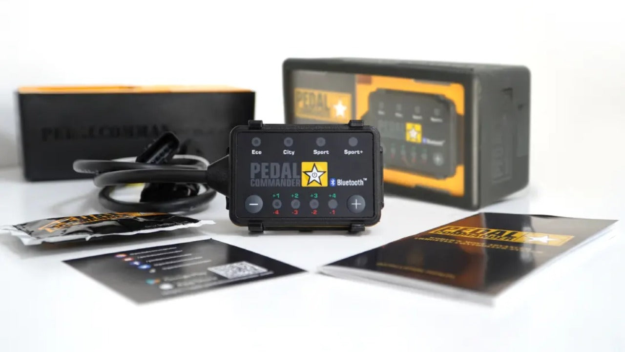
Pedal Commander® throttle response controller is the best addition to your overlanding vehicle. It is a simple upgrade that removes the lag from the electronic throttle system, unleashing your vehicle's true potential. Whether you’re navigating through mud or snow, crawling over rocks, or driving on rough terrain, Pedal Commander® will enhance your journey. With its 4 modes and 36 settings, you can adjust your vehicle's throttle sensitivity precisely for your style and driving conditions.


